

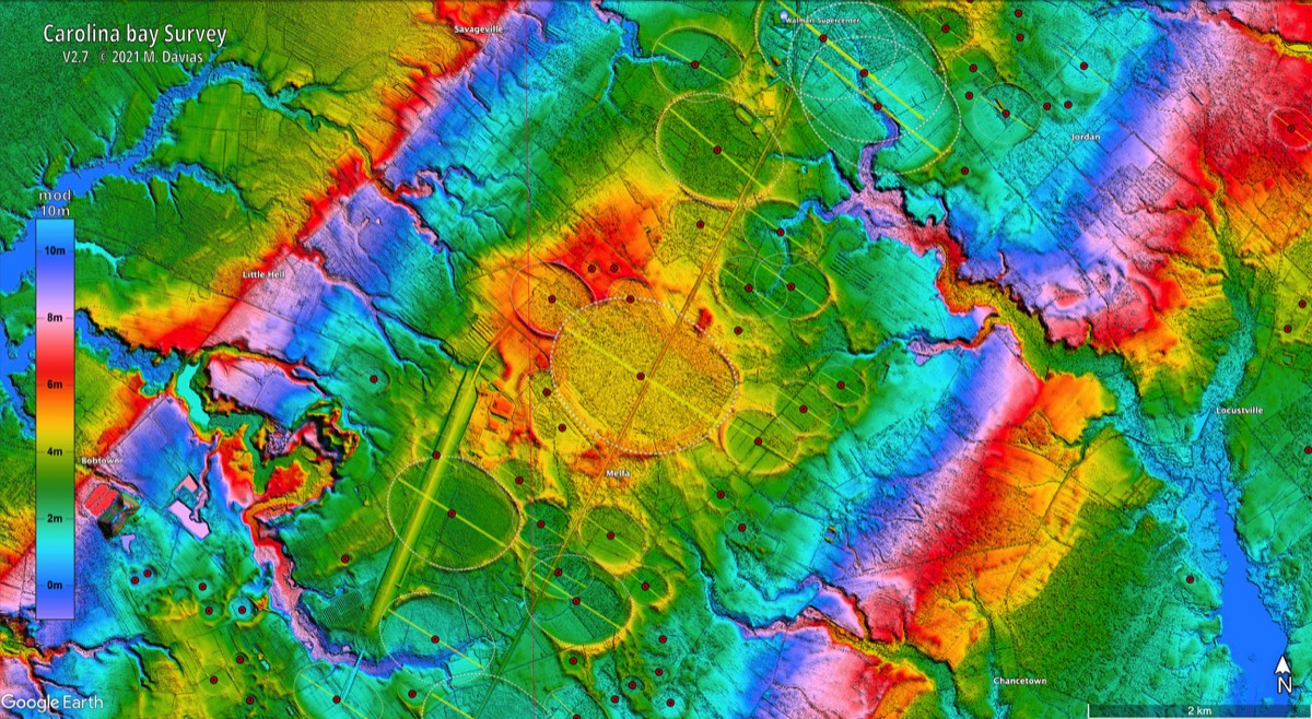

Greetings: The landforms are clearly circular. The "oval" shapes are a result of the photography angle.
Desert bays?
4 archived comments · Oldest first
No S*%#$, Sherlock:)
Hi George, I couldn't get the comment block to open up on the excellent 'Clayton's craters' post. But these structures go to the question you've posed there. I think we are looking at a mixture of both volcanism, and impact scars. Which means it is going to be a long time before we can come up with a conclusive answer. But if it's ok to give one's best guess, for these, I'll lean towards a very large, multiple fragment impact storm a only few thousand years ago. Most likely a broken up, icy comet. Unfortunately, the target zone was an ancient volcanic field. So that any otherwise conclusive evidence of impacts is going to be contaminated with solid evidence of volcanism, and visa versa. But consider that the Sphinx was buried up to his neck in the sands of the Sahara until modern archeologists dug him out. And then mentally subtract the windblown sands from those images of over-lapping ring-walled structures. That place might always be an enigma. But I don't believe those blast burnt facies are anywhere near as old as they say. The weakest link in standard landform theory is in the time honored, 19th century practice of doing geo-chronology by mutual inter-assumptive uniformitarian confabulation. If the age of those rocks wasn't arrived at by modern radiometric methods, I just ain't buying it. And I remain to be convinced of the dependability of some of those methods as well, when a large airburst event is suspected. Firestone, and friends cited Toon et al in the 2007 paper, when they proposed temps as high as 10^7 deg. C. in the Younger Dryas impacts. That's ten million degrees folks. But then they just drifted right on past the significance of the energies such temps describe. And although they didn't ask them, that figure begs questions for the plasma physicists. How do we expect matter to behave when we elevate its temp so high that all of the electrons, and protons, are stripped from the nuclei? First of all, and probably most important, is that no matter what it is in it's cooler state, it is now a completely ionized thermal plasma. And it is a superconductor. Its heat flows electrically. Such a plasma can be contained by magnetic fields. Even those generated by it's own electrical currents. So it self-organizes into actual structures like beams, filaments, and double layers. In short, the stuff can be expected to behave almost like a thing alive. And those twisting filaments of thermal plasma should bare a startling resemblance to the ancient descriptions of fire breathing dragons with breath so hot it can melt stone. Google the work of Anthony Peratt, at Los Alamos National Lab for extensive experimental research into electric plasma phenomena. And a detailed explanation of compelling evidence that ancient peoples all over the world have witnessed very high energy plasma events in the skies above, and left drawings of what they saw in ancient rock art on every continent. The powerful magnetic fields of the twisted pairs of filaments that can organize, and form, in such a plasma can produce intense synchrotron radiation. And that's where the radiometric data becomes questionable. Because of the potential for random ion implantation anomalies, especially anywhere a large plasma discharge event has hit the ground. (the center of of an airburst impact vortice is a superconducting plasma) When I asked Bill Napier what he thought of all that, he replied the he had a problem with the ten million degree figure that Toon et al provided. He pointed out that even if we bring a bolide in at 30 km/sec, and we translate 100% of the kinetic energy into heat in the atmosphere, we still only get somewhere in the neighborhood of 100,000 deg C. But he also noted that even at the more conservative temp. we are still talking about a very 'substantial plasma'. At that time it, hadn't quite dawned on me in that in a multiple fragment, airburst event, only the first pieces fall into cold atmosphere. The rest fall into already superheated impact plasma, and just crank up the heat, and pressure. The higher figure described in the Firestone paper doesn't seem such a stretch when you look at it in that light. Either way, It's time to re-think the standard model of an impact event. As for how much we don't know; consider this: On the other side of the world, In central Mexico we find the pristine Chihuahuan ignimbrites deposited in a continuous, random colliding, inter-flowing sheet of high speed, fluid density currents. The standard model for a density current, or pyroclastic flow, requires a slope to flow down to provide the motive force. Most of that stuff is on fairly level ground. So gravity wasn't the motive force there. It also requires a volcanic vent, and magma chamber to account for the material. And the heat and pressure to get the melted rock, and breccias into atmospheric suspension. No such rifting vent, or related supergiant magma chamber has ever been found to account for the nearly 50,000 sq miles of continuous interflowing ignimbrites. And yet except for a short stretch of 60 miles, or so, along the Chihuahua City - El Paso high way, they've never even been mapped. Let's put the questions of the source of the materials, or heat, and pressure, aside for a moment. A 50,000 sq mile pristine, continuous, interflowing, density current of flash melted stone, undisturbed on the surface, describes a geologically recent explosive event so vast that it makes the worst Yellowstone, or Toba, can throw at us seem like a mouse breaking wind by comparison. And yet no-one has ever really bothered to ask just what the hell happen there. We really don’t know anything about those materials, or the surreal landforms that rise among them beyond speculation. And that's only just across the border folks.
[ Norbert Brügge, Germany, highly expert geologist re Sarara desert ] http://www.b14643.de/Sahara/index.htm http://www.b14643.de/Sahara/Clayton_Craters/index.htm http://www.b14643.de/Sahara/Kamil_Meteor_Crater/index.htm 22.018298 26.088502 Kamil Crater (irons found) .595 km center el, .04 km center size, ejecta to SW, public ground photo on Google Earth ] [ Rich Murray on 2010.08.12 found this feature, similar in size and appearance: crater 23.265054 26.043734, .05 km size, 1.062 center el, dark ejecta to SW, SW Egypt wider ejecta ring to SW as much as .05 km, SW Egypt and others: 22.504862 25.898908 .670 km surface el, aligned craters on sand, SW Egypt 23.158935 26.009629 shallow grey crater on dark hard rock, 1.2 km wide, 0.998 km el low, 1.019 km by SW outer rim. SW Egypt 23.193999 25.935677 rare cluster of shallow craters on hard dark plateau,1.043 km surface el, SW Egypt 23.785060 27.027140, black hill 1.12X.57 km size, .804 km top el, .205 km above .599 km el by E end, with 4.54 km dark tail to SSE, SW Egypt ]