


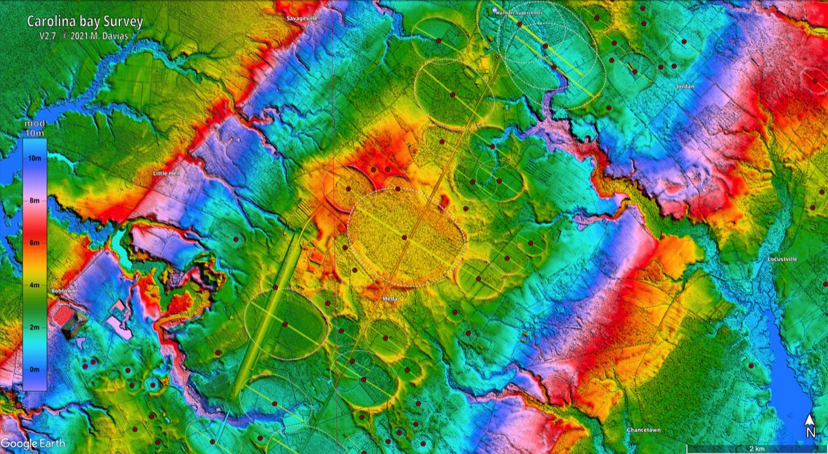

My crater wrong (Darwin's Valentine) has been extremely useful to me in helping to identify a preferred pro-glacial lake discharge nexus and in the Younger Dryas Lake Agassiz Moorhead phase discharge controversy, which is still ongoing. The dutch paper on the alleged Younger Dryas impact has shown up in the scholar searches and Andrew Madden's nanodiamond result is in PNAS peer review (such that it is), so the fun continues!
Heinrich disputes Burchard
7 archived comments · Oldest first
Visit the article and join the conversation →Regarding Mr. Heinrich assessment he Benavides Structure, I doubt that very many folks reading this blog will shell out the 60 bucks or so to drag it out from behind GSA’s pay wall; much less take the time to go down there and spend some time on the ground wandering in the desert to see it for themselves. (My own trip down there nearly cost me my left arm) But in fact the “highly detailed”, and “recent” work he’s talking about is based around two very crude, hand drawn maps done by a couple of graduate students back in the early eighties. Then 2010 F. W. McDowell simply kludged the two of them together into a single sad excuse for a geologic map that when laid over a very high resolution satellite image of the same area shows almost no correlation at all to the actual terrain features it is supposed to represent. In fact, in spite of the fact that he did his compilation in 2010 there is a complete disregard for any satellite data at all; much less satellite image data that’s not supportive of his own assumptions. The map, and McDowell’s commentary can be acquired at: McDowell, F. W., 2010, Geologic Map of Manuel Benavides area, Chihuahua, Mexico. Map and Chart no. 99 (http://rock.geosociety.org/Bookstore/default.asp?oID=0&catID=2&pID=MCH099F). Geological Society of America, Boulder, Colorado. This map and text cover an area of eastern Chihuahua state adjacent to the Rio Grande and the Big Bend of Texas. The area contains an 1100-m-thick volcanic section very similar in lithology and age (by Ar-Ar dating) to that exposed in both Big Bend National and State Parks. This includes, from older to younger, a heterogeneous sequence very much like to the Chisos Formation, a thick locally derived rhyolitic flow complex comparable to the Tule Mountain trachyandesite, distal thin ignimbrites similar in age to the Mitchell Mesa ash-flow tuff (the largest unit in the Trans-Pecos volcanic field), and a caldera source for both the 31 Ma San Carlos tuff and the 28 Ma Santana tuff. The caldera is an unusual trap-door type with a hinge zone on the southwest and two separate collapse and eruption margins around the north and east. Its outer diameter is approximately 25 km, which is unusually large for the tuffs that erupted from it, suggestive of a shallow collapse. Inflation or tumescence prior to the eruptions modified a preexisting Laramide fold by bowing it outward toward the north and east; a 31.5 Ma granitoid was intruded into the fold axis, resulting in the formation of skarn deposits in the surrounding limestones of the fold. So basically what McDowell proposes there (note that he states it as unquestionable fact) is the existence of a giant 17 mile wide, perfectly circular, hinged trapdoor that’s covering an as yet undefined super volcano sized magma chamber that’s prone to lateral blasts capable of explosively emplacing hundreds of cubic miles of lava, and thousands of cubic miles of ash, and debris in an eruptive event. But he gives no explanation of the crazy mantle physics required for a perfectly circular, hinged trapdoor vent. Nor does he give any consideration to the physics required for the kind of explosive event he’s proposing. There is also no mention in that paper whatsoever of the mountain sized piles of mega breccias that ring the southwestern edge of the ring structure. In this case “highly detailed” is a hand drawn geologic map done by a couple of kids back in the ‘80s that wouldn’t get a passing grade in a 5th grade, science class of today. And “recent” means that in 2010 it was explained by 20 pages of geophysical baffle-speak that just doesn’t stand up to close scrutiny.
Above posting on Tusk by Paul Heinrich, LSU and Louisiana Geologic Survey, -- not as I first thought the slightly more famous Hartmut Heinrich of Heinrich events, -- is a welcome contribution on a geological event of great importance for the human tribe. However there are several serious flaws in how he argues and presents his negation of the Spratlies crater as an impact structure and hence its relevance for the Australasian tektite (AA) impact, that I feel obliged to bring to his attention, thinking that he might read these comments. I may refer him to my Tusk comment posted November 13, 2013 at 4:54 pm, in addition to the earlier Tusk posting, where George Howard graciously posted my email to Ed Grondine & to a Cc list including George, who gave it the title, ``Crater Burchard?'' His remarks suggest that he has not carefully read, or not considered fully, these my explanations. 1.) Paul cites the Tusk posting as my contribution incorrectly as follows: Burchard, H. G. W., 2013, Crater Burchard? The Cosmic Tusk. November 3, 201 Whereas as mentioned the title is George's, not mine and cannot be used to suggest that I have attempted to name and take credit for the crater with my name, in my Nov 13 commenting specifically ``what I would call the Spratlies Crater.'' 2.) As I already had give to the feature the name of "Spratlies crater" he is not entitled to rename it, as he writes ``this proposed impact structure will be referred to as the "Spratly Islands Impact Structure" for purposes of discussion.'' 3.) He cites as relevant the article: Hutchison, C. S., and V. R. Vijayan, 2010,, What are the Spratly Islands, for which George had posted link. But as pointed out in my Nov 13 comment this paper is completely irrelevant for the impact crater itself, although important for interpreting the effects of the impact on the surrounding landscape: The article entirely misses the crater and indeed is addressing areas S or SE of the crater. Only a few of the reefs mentioned straddle its S or SE margin. 4.) He completely ignores the land slide which is have prominently discussed in my initial posting. 5.) ODP leg 184, bore hole 1143 is located at 9.362 N, 113.285 E, a site that just barely touches the outermost discernible rim of the crater, not as he writes ``just within the alleged rim of the proposed'' Spratlies crater (he, of course, uses his own illegitimate name here.) One would not expect a drill hole there to contain any impactites. Especially considering this was an oceanic impact and the huge 275 km size is probably due in part to the water wave moving the seafloor along and making ground swells that way. There is much more to be said as I have in several emails as to the identification from the impact exploding within a mass of collapsing continental shelf on the SW flank of the S China Sea and creating an embayment, which of course means that a large amount of the weakly consolidated continental slope sediments was blown into space as AA tektites. The predominantly southerly extent of the strewnfield is explained becasuse in this direction the overburden of soil converted into ejecta was largest.
Hello to all I gave up trying to engage with this kind of "scientist". In Brazil and around the world, they are more than 90%. They are junk! Even those who publish in the most prestigious indexed journals. Of course, not all is lost, they can also be recycled. They keep throwing garbage under the rug, stay alert. They have at their disposal scientific and financial resources. Only themselves could confuse or argue with a wheel of Agriculture for the impact crater. They always try to denigrate the uninitiated. Or, who knows, may be some sort of jealousy, because the information is on the internet since 2005 and they have not seen ............... I do not have the means they have. However, I've applied scientific principles that I learned in high school and knowledge acquired later, of course. Images increasingly higher definition leaves no doubt for the first selections of cosmogenic possible candidates. I have traveled by car within 300 km, or even plane, for distances greater than 700 km to collect possible impactites. I did not always find them. But one or two in a dozen structures visited, possible impactites are found. Already more than 10 probable or possible structure I have confirmed in 5 different fields palaeolagoons. Focusing on this hypothesis, I began research in 2009. I have not yet started to catalog the 11 kg of rock samples that I collected on my last expedition to the region of Petrolina, last November. Soon I will update my page. Yes, the palaeolagoons are probably cosmogenic. best regards pierson
I sent Paul an image of a possible shallow impact crater within the known impactite field. At first he pointed out an irrigation complex within it. It only takes Paul a short time to do geological research. I am hoping he provides me with some pointers to the existing data on the Mississippi drainage ca 10,850 BCE.
Ed, evidently the rifting making horsts and cuestas SW of the actual crater is from the continental shelf and slope collapsing due to the impact explosion. If you read some of his references, the Miocene date for the rifting event is mere guess work. Only one atoll was cored, the date was Pleistocene. This is the only solid age for the Dangerous Ground. Did you read my rebuttal above, the flaws in his note? BTW, he is practically quoting you verbatim, not to name craters after people. Instead, when you wrote to him, you might have explained to him that George named the crater with my name, not me.
Anyone; Can anyone explain to me how a trapdoor cauldera works. Is it similar to a ball check valve or a swing check valve? I would think that the cauldera would need subterranian PSI to stay closed then it would open with PSi drop? Or does the door float on the magma and open with level loss possibly leaking magma until the levels return to "normal" and seals the cauldera again?