
A Younger Dryas Discovery Hiding in Plain Sight at Smith Mountain Lake
Just below the dam, a centimeter of river sediment may preserve a trace of the catastrophe I believe changed human history 12,800 years ago.
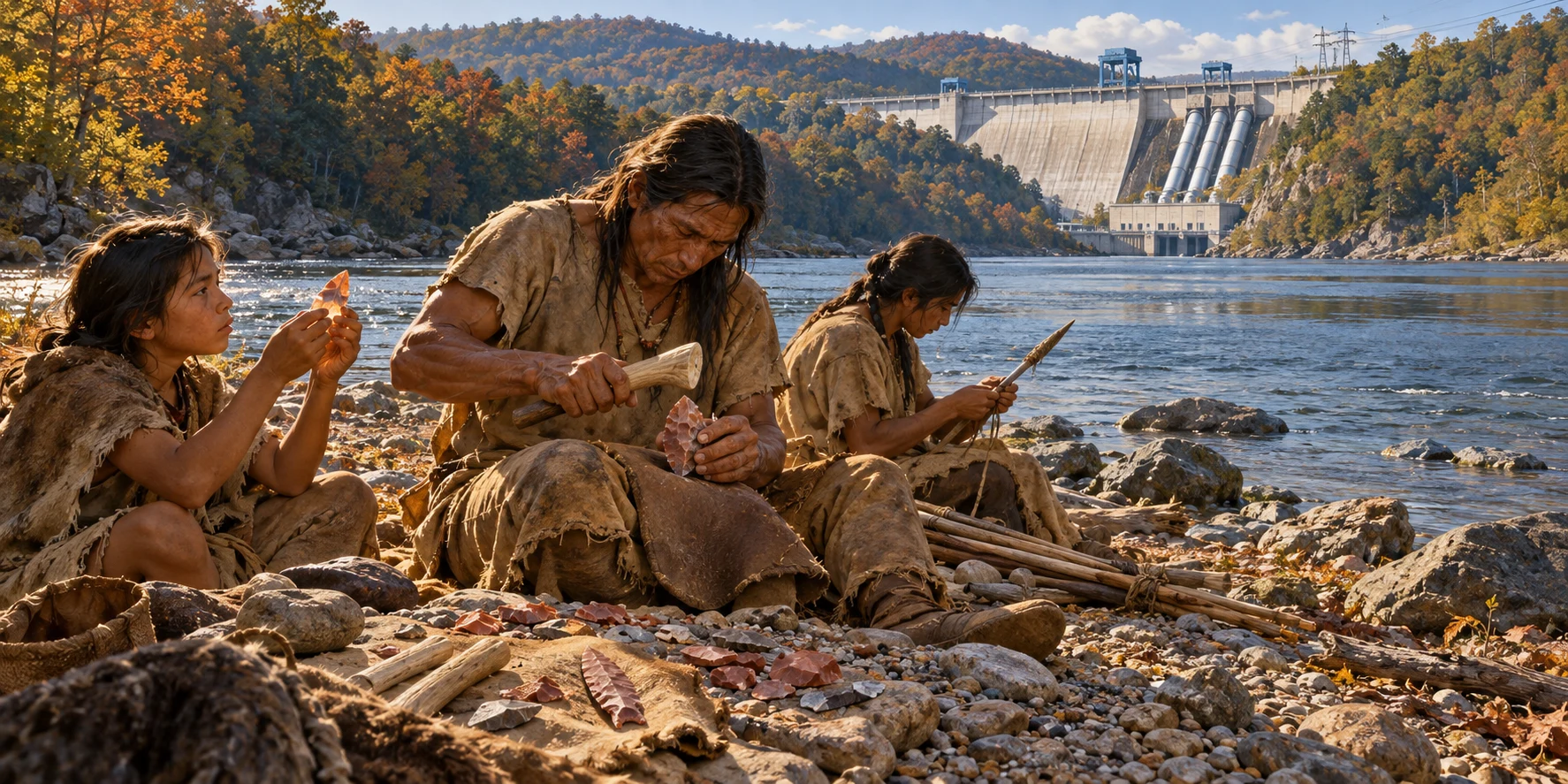
I’m writing this from a friend’s house on Smith Mountain Lake, where I’ve spent weekends over the years. I’ll be sending this one to friends who regularly visit the lake with me. You know the gap where the dam sits. Did you know that just downstream, archaeologists found stone points made by people who camped along the Roanoke some 13,000 years ago? I’ve been coming here for years, and I’d missed that part of the local history.
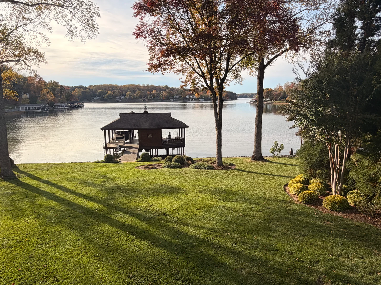
Here’s why I’m writing about this particular riverbank. I believe it holds a trace of a terrible catastrophe 12,800 years ago, when debris from space struck Earth or exploded in the atmosphere as the Younger Dryas cold interval began. In my view, that catastrophe was the most important event in human history. And here, just below a dam my friends know well, we can look at a layer from its approximate time in the very ground where Clovis people worked stone.
My science buddy, Christopher Moore, led the study that brought this home to me. Chris and I are both co-directors of the Comet Research Group. What I’d love for my friends to see is what makes this particular bank so unusual. In a stretch of river we all recognize, enough of the old floodplain survived for archaeologists to study the tools people left there alongside a record of the climate they lived through.
For much of the twentieth century, American archaeologists treated Clovis as the earliest secure evidence of people on the continent. Older sites have since pushed that history back, but Clovis still gives us something rare. Across much of North America, people shaped stone points in a distinctive way during a span of only a few centuries. Archaeologists can use those points to compare what people were doing in far-apart places as the last Ice Age drew to a close. One of those places turns out to be just below this Virginia dam.
The name takes a little sorting out. The archaeological site is on the Leesville Lake side of the dam. Long before there were two reservoirs here, the Roanoke River ran through Smith Mountain Gap and laid down sediment along its banks. People made and used stone tools there. The same river that buried their work is exposing it again.
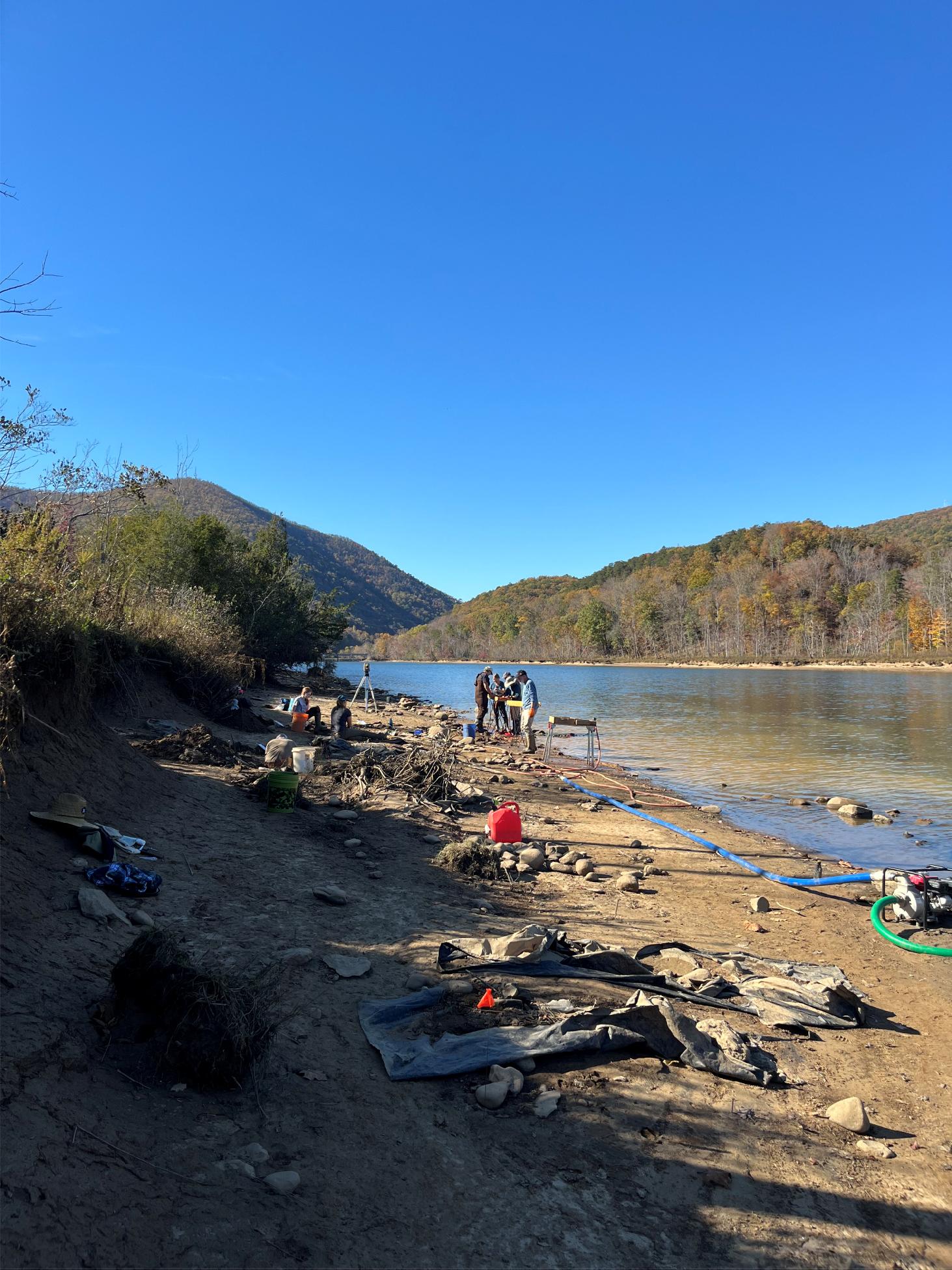
Three points from a small patch of riverbank
William Childress described a buried fluted-point occupation here in 1993. The work depended on people returning to the eroding bank and catching artifacts while they were still lodged in the sediment. Once a point washes loose, you can recognize its shape, but you’ve lost the layer that held it. Childress’s early field report.
One cluster yielded three Clovis points and tools made of Paoli chert, a stone the researchers think came from Kentucky. Most of those tools turned up within an area only about four meters across. That patch of ground gives us a glimpse of people carrying stone across the landscape, choosing a place beside the river and leaving behind enough of their toolkit for someone to recognize it thousands of years later.
Clovis knappers removed a long flake from the base of a point, leaving the groove we call a flute. Their distinctive points give archaeologists a way to compare widely separated sites during a remarkably short span, roughly 13,050 to 12,750 years ago. Toward the end of that span, the Northern Hemisphere entered the cold interval called the Younger Dryas. A change in the tools people made is one thing we can trace. What became of the people who made them is a much harder question. Waters, Stafford and Carlson on the age of Clovis.
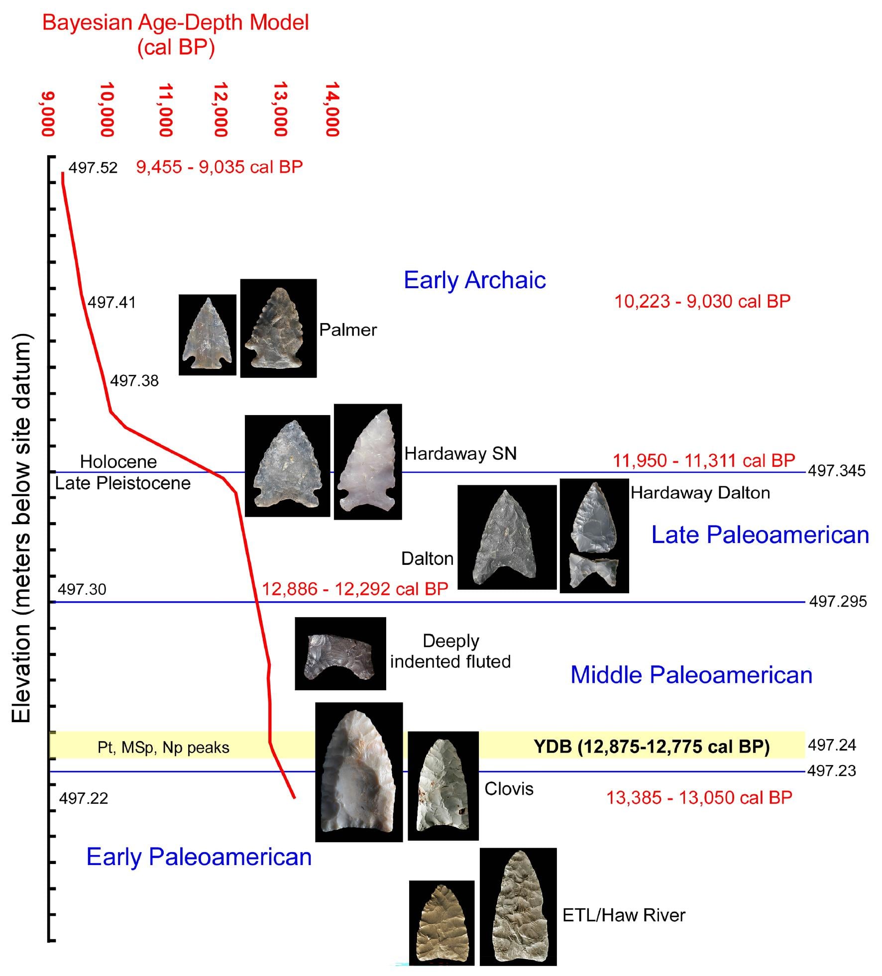
Follow the yellow band
In 2026, Christopher Moore and colleagues published a different kind of find from the terrace. They sampled a column of sediment one centimeter at a time. In Figure 11, follow the yellow band across the sediment column to the blue dots marking microspherule abundance. Its position, 14–15 centimeters down, is measured from the top of the sampled column. It tells you where to look in the excavation, not how far to dig below today’s shoreline.
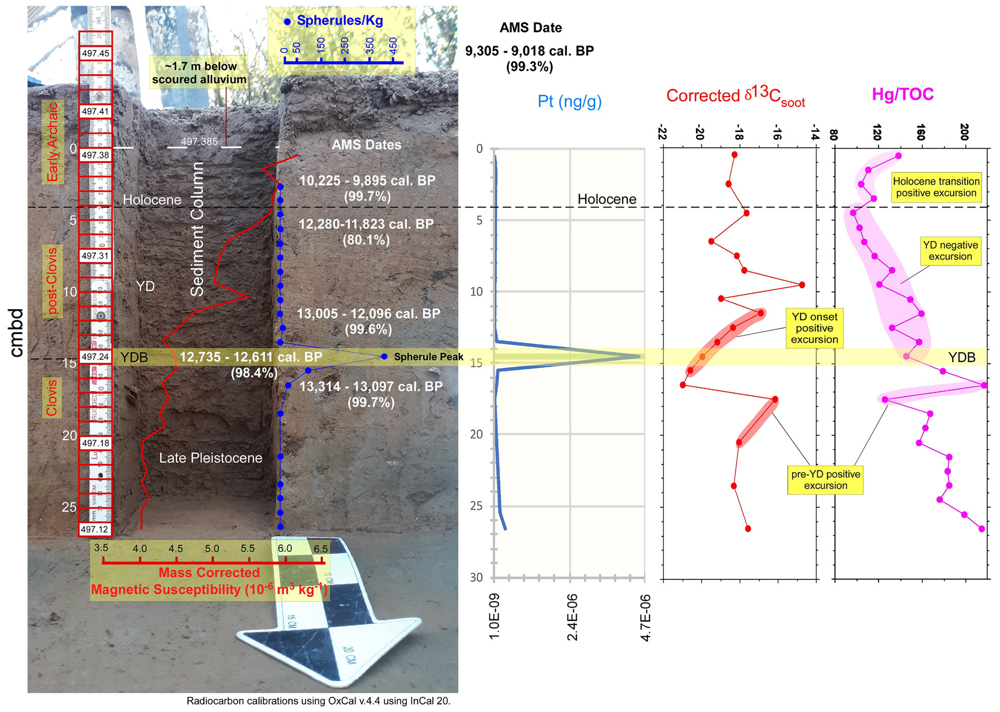
Table 3 puts numbers to that stripe. The team counted 40 microspherules in 90 grams of sediment from the highlighted centimeter. In the sample immediately above, they counted zero. In the one below, ten. A peak in platinum-bearing particles accompanied the spherules. That concentration is easy to miss on a shore visit, even if you know which bank to look at.
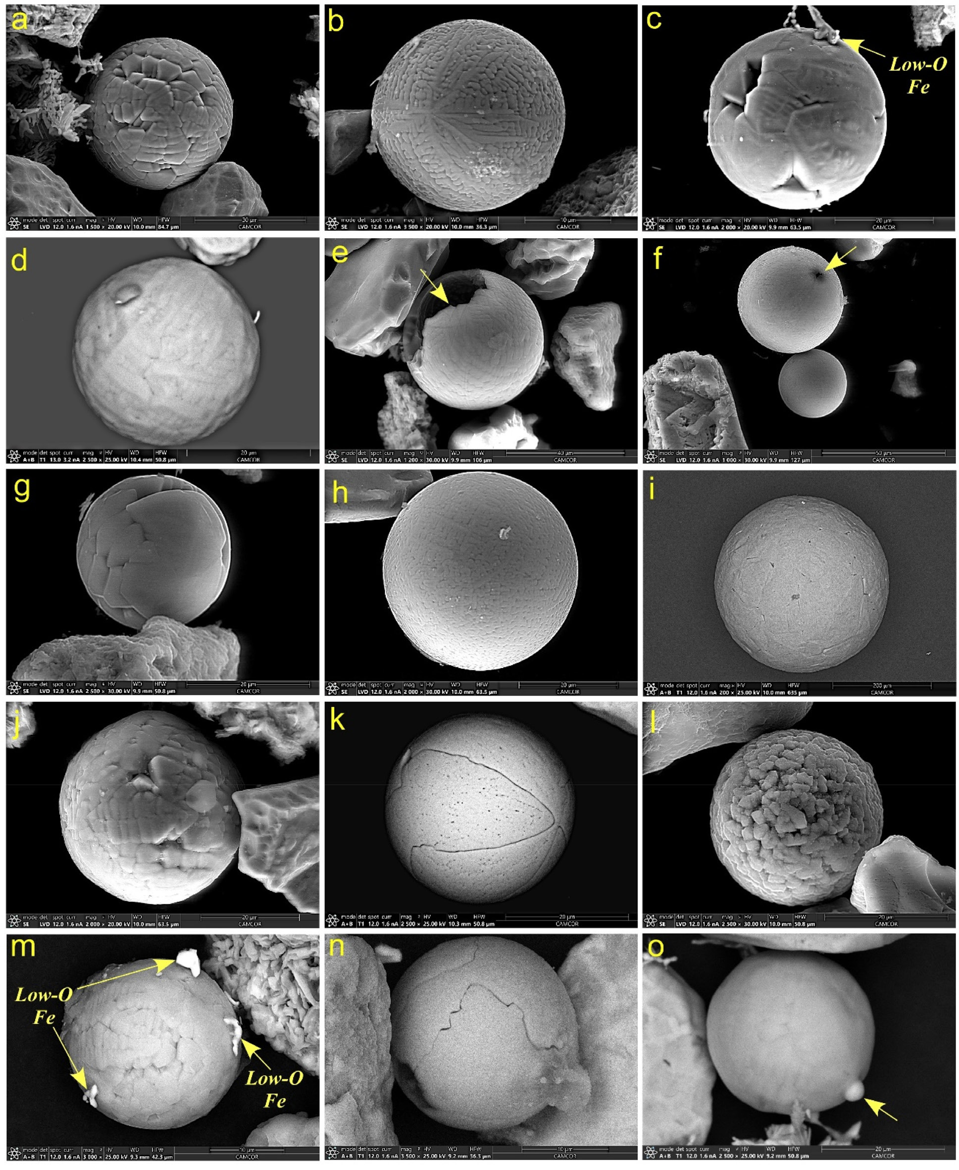
What draws me to the impact hypothesis is that the team could put a finger on one particular centimeter of this bank and show what was in it. The concentration of microspherules and platinum-bearing particles gives us something to compare with deposits elsewhere. The Virginia dates overlap the onset of Younger Dryas cooling, with an uncertainty of several centuries. The study documents the layer. Whether the particles came from a cosmic impact or airburst is the question the measurements leave open.
After years of coming to this lake, the picture I’ll take home this weekend is that narrow yellow stripe. Someone had to notice a tool before the river carried it away. Someone else had to sample the bank one centimeter at a time. Because they did that work, I can look across a lake I’ve known for years and picture the people who worked stone along this river. What happened to them when the world changed 12,800 years ago? That’s the question I’ll carry home.

Paper and figures. Christopher R. Moore et al., A 12.8 ka microspherule and nanoparticle marker horizon in stratified Paleoamerican deposits at Smith Mountain Lake (44PY152), USA, ScienceOpen Research, August 19, 2026. Figures 2, 5, 11, and 12 reproduced unchanged with new captions. Read the study · CC BY 4.0.
Read Chris Moore and colleagues’ Smith Mountain Lake study (PDF)
Read the paper · scroll inside the window