
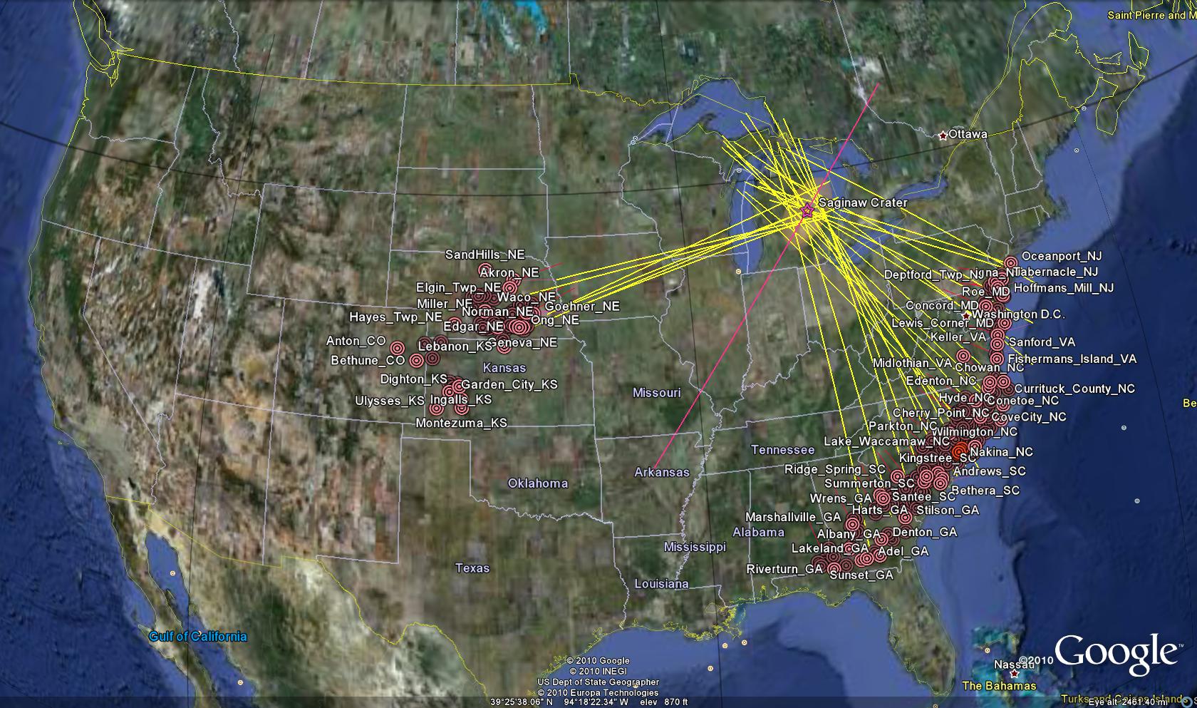
Wow. Michael Davias at Perigee Zero keeps stripping the hide off the ball for Carolina Bays. He has investigated, identified and, most importantly — visualized and shared — some extraordinary info on the range and character of bays in the Southeast and Midwest.
The screenshot below only scratches the surface of what Mike has put out there for all of us. See the full data in a Google Earth .kml file by downloading Google Earth and clicking here: [http://cintos.org/ge/SaginawKML/WebPlugIn_Summary.kmz]
I was able to view the data quite well but want to know that others can too. So let me know if you have any problems or questions.
Those lines seem to measure as straight lines. They should be Great Circle Arcs. Yesterday on GE I was making some long measurements, and they were arcs, not straight lines. It seems odd that these are all straight.
Also, I’d be interested if any allowance is being made for time in flight. I have no decent guess at the ejecta average velocities, nor how high they might have been ejected. Put together with the ellipticities of the Carolina Bays (indicating a reasonable estimate of the angle of impact) and ballistics formulae, it seems that fairly good time-in-flight numbers could be determined.
If some existing data is out there and if I had a decent ballistics formula, I’d take it on myself, but I haven’t been able to find anything online.
And a question: On GE, the “landing” end of those paths – some of them have a thin red line attached. What is that about?